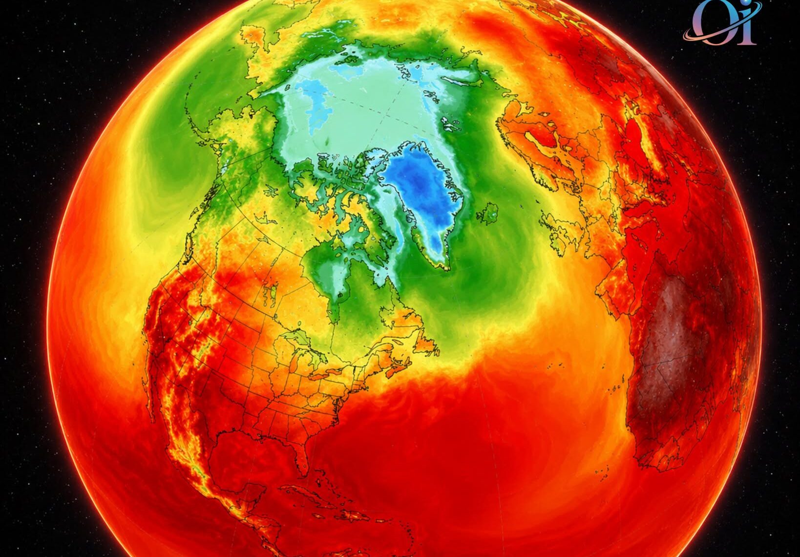
NASA has released a new map showing modeled air temperatures across the continental United States, highlighting an intense heat dome centered over the Plains and neighboring states. Heat domes develop when a strong area of high pressure traps hot air near the ground while limiting cloud formation and cooling winds, allowing temperatures to rise and remain elevated for several days. In some areas, weather stations in Montana, Utah, and Wyoming recorded some of their highest temperatures since observations began in the early twentieth century.
When high humidity accompanies extreme heat, conditions can create a dangerous “steam-cooker” effect that makes temperatures feel even hotter. Extreme heat poses serious health risks, particularly for older adults, young children, outdoor workers, and people without reliable access to air conditioning. It can also strain power grids, reduce air quality, and increase the risk of wildfires. Smoke drifting south from Canadian wildfires may temporarily reduce sunlight in some locations but can further worsen air quality and create additional health concerns.
According to NASA, heat waves have become more frequent across the United States over recent decades, with the average number of summer heat waves increasing from about two per month in the 1980s to roughly four per month between 1980 and 2023. Scientists continue monitoring these events to better understand their causes, improve forecasts, and help communities prepare for the growing risks associated with prolonged periods of extreme heat.